


NOTE: The following summary information is to help with hike selection and is not intended to be used for hiking the trail. For your safety and enjoyment, please obtain a copy of Sedona Hiking Guide which is available here.
Summary: A hike that takes you down to the banks of Oak Creek
Challenge Level: Moderate
Hiking Distance: About 2 1/2 miles one way, 5 miles round trip
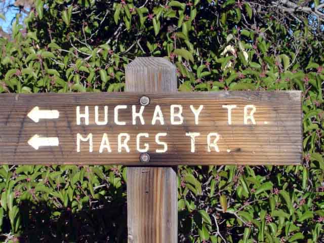
Trailhead Location: There are two trailheads for this hike. One parking area is located off of Schnebly Hill Road. The other is located at Midgley Bridge.
Description: The Schnebly Hill Road trailhead is shared with the Munds Wagon trail. The Huckaby trailhead is on the west side of the parking area. The trail rises and falls as you approach Oak Creek. You have views of "Lucy," "Snoopy," Cathedral Rock and Uptown Sedona. Then you descend to the eastern bank of Oak Creek. Unless the water is low and you want to cross to the other side of Oak Creek, end the hike where the trail comes to Oak Creek, just north of Uptown Sedona.
Here's a link to a video from our March 2011 hike (http://youtu.be/gaK6ORwMWkQ).
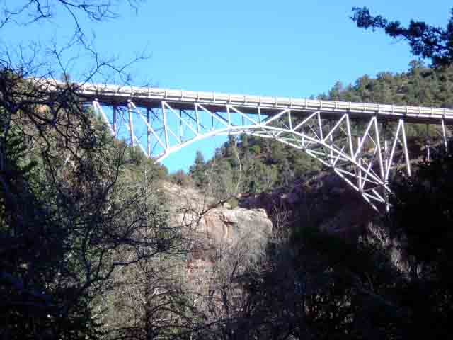
If you can cross Oak Creek, proceed on the western side of Oak Creek along the slickrock bank. After about 0.3 miles of following Oak Creek you'll come to the continuation of the Huckaby Trail. Follow it up to Midgley Bridge and a fine view area.


Below are photos from our a hike where we started at the Midgley Bridge trailhead


For those of you who have a GPS unit, I have GPS data available for the hike which include "tracks," the route and waypoints.
Great Sedona Hikes
Last Updated March 31, 2021
Web Page by Bill Bohan (hikebook@greatsedonahikes.com)
send an email
with your comments/suggestions to Bill